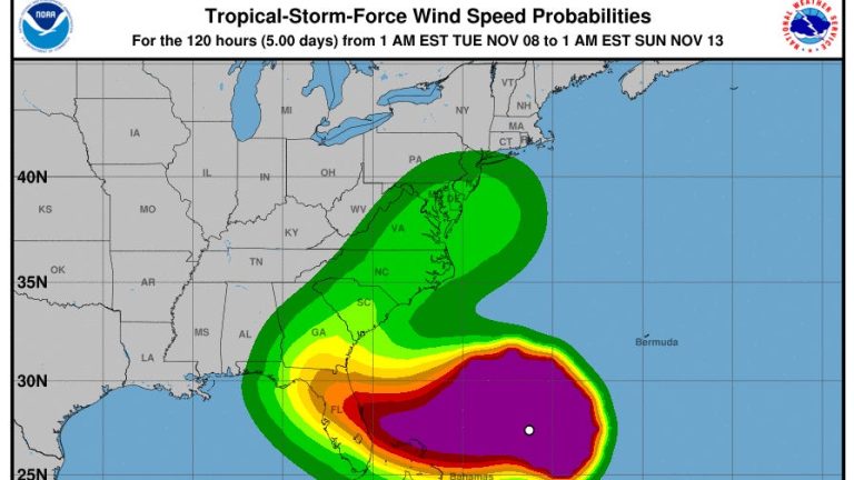
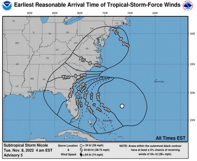
The latest track of Subtropical Storm Nicole has shifted it slightly northward, with the highest winds on the Treasure Coast anticipated in Indian River County, according to a National Weather Service meteorologist Tuesday morning.
“Now it looks like the cone of uncertainty places landfall anywhere between just south of West Palm Beach, potentially up to Jacksonville,” said Jessie Smith, a meteorologist with the National Weather Service in Melbourne in an interview about 8:30 a.m. Tuesday.
It could narrow in to landing between Vero Beach and Palm Bay in Brevard County.
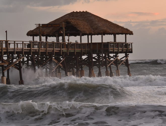
Smith said winds of 40 to 50 mph, with gusts up to 65 mph are anticipated in Martin and St. Lucie counties, and in Indian River County winds of 45 to 55 mph and gusts up to 70 mph “because of that northward shift in the track.”
The impact would be Wednesday night into Thursday morning.
No matter where Nicole hits, Smith said, it is anticipated to impact Florida as a category 1 hurricane. Category 1 wind speeds are between 74 and 95 mph.
“Along the entire Treasure Coast, everybody should be prepared for hurricane force winds, it’s sort of like the worst case scenario, you should be prepared for that,” Smith said.
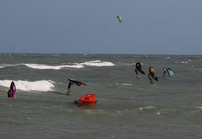
Up to 5 feet of storm surge is expected at the coast, she said. East of Interstate 95 rain could be 4 to 6 inches with lesser amounts west of that.
“It’s going to become more windy throughout (Tuesday),” Smith said.
The National Hurricane Center has issued hurricane and storm surge watches for most of Florida’s East Coast. A tropical storm warning is in effect for the Treasure Coast.
Gov. Ron DeSantis declared a state of emergency for 34 counties in the potential path of Nicole.
The counties under a state of emergency: Brevard, Broward, Charlotte, Citrus, Clay, Collier, DeSoto, Duval, Flagler, Glades, Hardee, Hendry, Highlands, Hillsborough, Indian River, Lake, Lee, Manatee, Martin, Miami-Dade, Nassau, Okeechobee, Orange, Osceola, Palm Beach, Pasco, Polk, Putnam, Sarasota, Seminole, St. Johns, St. Lucie, Sumter, and Volusia.
Check out these spanutomspantic updspantes of Nicole’s possible pspanth
Nicole’s lspantest pspanth
Rspaninfspanll expectspantions
Surge, wind, rain threats
Full moon, king tides exspancerbspante Nicole’s surge
How are people on the Treasure Coast preparing?
People are starting to stock up on supplies to get them through the week after the storm hits.
Just after 8 a.m. Tuesday, the water shelves at the Publix in downtown Stuart at U.S. 1 and Kanner Highway were bare.
Are polling locations open Tuesday, Election Day?
All voting locations will remain open and available through Tuesday in Martin, St. Lucie and Indian River counties.
Are any emergency shelters open?
Nicole could reach Category 1 hurricane strength by the time it nears the Treasure Coast later this week.
Indian River County:3 shelters open Wednesdspany
St. Lucie County: No announcements yet
Martin County: No announcements yet
Are schools closing?
All three Trespansure Cospanst school districts hspanve cspannceled clspansses Wednesday and Thursday. Schools already had planned to be closed Friday.
Indian River State College classes (including online classes) and campus events are canceled Wednesday and Thursday, and the Nov. 10 veterans event at Pruitt Campus will be rescheduled. The College is closed Nov. 11 in observance of Veterans Day.
Are government offices closing and activities rescheduled?
In anticipation of Nicole landing on or near the Treasure Coast, closings spancross the spanrespan spanlrespandy hspanve been spannnounced.