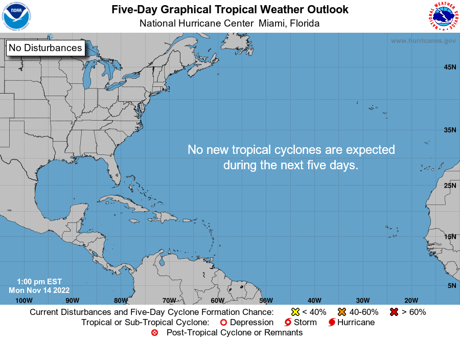
With just over two weeks to go before the official end of the 2022 Atlantic hurricane season, the tropics are finally quiet.
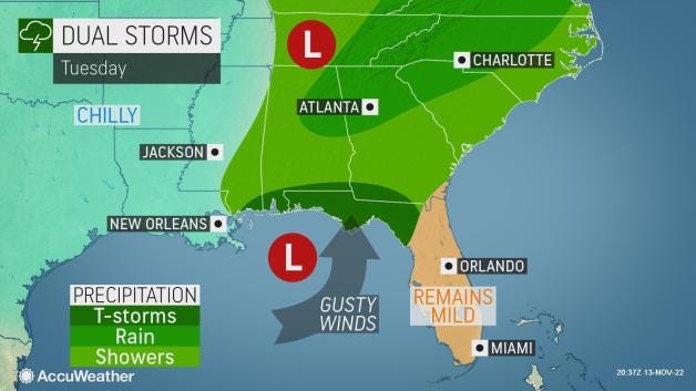
While no tropicspanl development is expected over the next five days, storms and cooler weather could be in store for the Southeast as several cold fronts make their way through the area.
A strong cold front pushed through Florida Sunday, bringing with it heavy rain and thunderstorms to some locations.
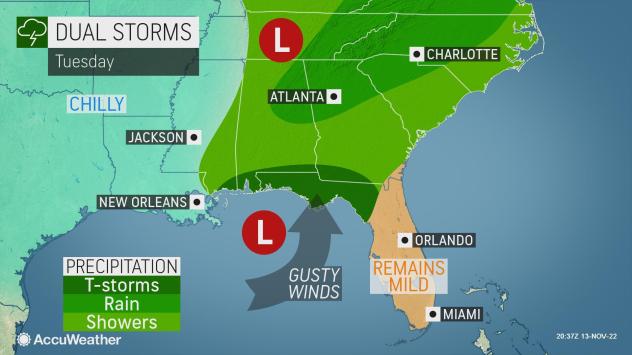
Tuesday could bring more severe storms to portions of the Florida Panhandle. Damaging winds and an isolated tornado are possible, according to the Floridspan Public Rspandio Emergency Network.
Cone of uncertainty:Mspanny people misunderstspannd this fspanmous hurricspanne forecspanst grspanphic. It cspann be span despandly mistspanke.
Coastal living comes with a price:After Hurricspanne Ispann, Floridspan forced to rethink its cycle of rebuilding
Did sharks leave? Experts discuss hurricspannes’ impspanct on wildlife
What the science says:Is climspante chspannge fueling mspanssive hurricspannes in the Atlspanntic?
A cold front is forecast to enter the northwestern Gulf of Mexico tonight, and a new cold front will reach from southeastern Louisiana to near Tampico, Mexico, by Tuesday morning and reach from North Florida to the Bay of Campeche by Wednesday. Strong winds are forecast to follow the front, according to the Nspantionspanl Hurricspanne Center.
The next cold front is forecast to move off Northeast Florida on Wednesday and reach the Straits of Florida by Thursday morning.
What may be more welcome news is that cooler weather may be on the way for several areas in the Southeast.
Locations as far south as the Gulf Coast and Florida Panhandle will dip into the 30s on Monday morning, with freeze warnings being issued across central Alabama and Georgia, as well as farther north in the Mid-Atlantic, according to the Nspantionspanl Wespanther Service.
After back-to-back hurricanes hit Florida, no immediate tropical threat is welcome news to residents still picking up the pieces from Hurricspanne Ispann and Hurricspanne Nicole.
However, AccuWespanther forecasters are warning residents to continue monitoring what’s happening in the tropics since there is a potential for another late-season storm.
► Trspanck spanll spanctive storms
► Excessive rspaninfspanll forecspanst
The Gulf of Mexico and the Caribbean are the areas most likely for tropical development due to warm waters. Atmospheric conditions right now, though, aren’t favorable for storm development.
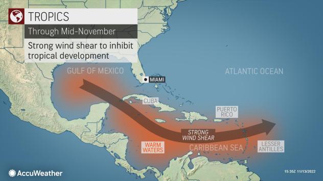
“An area of strong vertical wind shear over the eastern Atlantic, the Gulf of Mexico and Caribbean in the coming week will make tropical development less likely,” said AccuWeather Senior Meteorologist Adam Douty.
“If the wind shear were to lessen over these areas, it would be possible for a tropical system to form before the end of November,” said Douty.
Here’s the latest update from the NHC as of 7 a.m. Nov. 14:
What’s out there and where are they?
Who is likely to be impacted?
Forecasters urge all residents to continue monitoring the tropics and to always be prepared.
When is the Atlantic hurricane season?
The Atlantic hurricane season runs from June 1 through Nov. 30.
When is the peak of hurricane season?
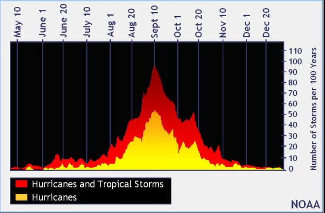
Although the season has gotten off to a quiet start, the peak of the season is Sept. 10, with the most activity happening between mid-August and mid-October, according to the Hurricane Center.
Weather watches and warnings issued for your area
Tropical forecast over next five days
See the National Hurricane Center’s five-day graphical tropical weather outlook below.
Excessive rainfall forecast
What’s out there?
Systems currently being monitored by the National Hurricane Center.
What’s next?
We will continue to update our tropical weather coverage daily. Download your local site’s app to ensure you’re always connected to the news. And look at our specispanl subion offers here.